bilde topografi av Frankrike

forward


bilde topografi av Frankrike
album
Download   [2000x1898]
forward
topografi av Frankrike - Bilder til bruk i skole og utdanning

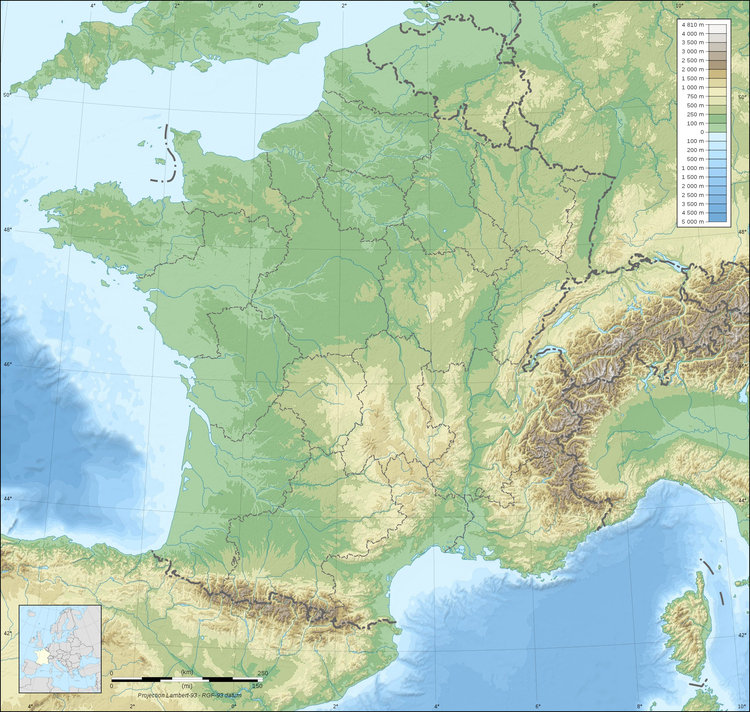
Kategori: bilde Kart > topografi av Frankrike

Fargeplate, bilder å fargelegge, tegning, illustrasjon, bilde: topografi av Frankrike

Nøkkelord: topografi av Frankrike, ,

Image information

Attribution and Share-Alike required
Any use of this map can be made as long as you credit me (Eric Gaba – Wikimedia Commons user: Sting) as the author and distribute the copies and derivative works under the same license(s) that the one(s) stated below. A message with a reply address would also be greatly appreciated.


Sources of data:

  • Topography: NASA SRTM30 (public domain);
  • Bathymetry: NGDC ETOPO1 (public domain);
  • Additional data: NGDC World Data Bank II (public domain).

Blank topographic map of France in the official Lambert-93 projection, with regions boundaries.


All images can be used for private educational, non-commercial purposes.
For all other use see Image License and/or Terms of Use.
Plz feel free to contact us for more information.


All images can be used for private educational, non-commercial purposes.
For all other use see Image License and/or Terms of Use.
Plz feel free to contact us for more information.

Copyright infobilder.com